The tradition & historical record
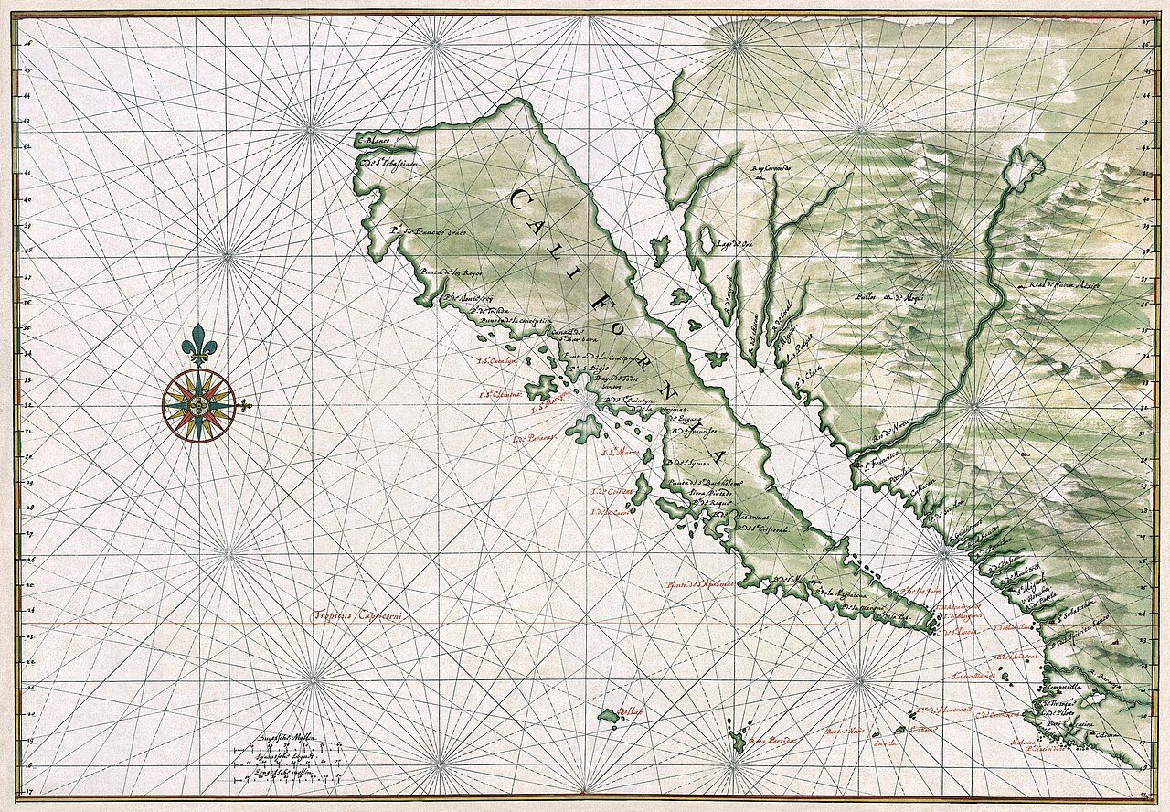
3 min read · 2 sourcesIsland of California (Spanish: Isla de California) refers to the long-held global misconception, dating from the 16th century, that the California region was not part of mainland North America but rather a large island separated from the continent by a strait now known to be the Gulf of California. One of the most famous cartographic errors in history, it was propagated on many maps during the 17th and 18th centuries, despite contradictory evidence from various explorers. The legend was initially infused with the idea that California was a terrestrial paradise, like the Garden of Eden or Atlantis populated entirely by Amazonian women and protected by griffins. This mapping error was not a one-off event. From the mid-1500s to the late 1700s great controversy surrounded the geography of California. For instance, a Spanish map from 1548 depicts California as a peninsula, Historian Dora Beale Polk argued that the belief was perpetuated through "uncritical repetition", and that California appeared regularly as an island on maps beginning in 1622. A 1626 Portuguese map depicts the land as a peninsula, while a 1630 British map depicts it as an island. A French map from 1682 only shows the tip of the Baja Peninsula. There are slightly over 1,000 maps in Stanford's Glen McLaughlin Collection of California as an Island, the largest collection of such maps in the world. 1
History
The first known mention of the legend of the "Island of California" was in the 1510 romance novel Las sergas de Esplandián by Garci Rodríguez de Montalvo—the sequel to Montalvo's more famous tales of Amadís de Gaula, father of Esplandian. He described the island in this passage: 1
Know, that on the right hand of the Indies there is an island called California very close to the side of the Terrestrial Paradise; and it is peopled by black women, without any man among them, for they live in the manner of Amazons. It is thought that, because of the widespread popularity of Las sergas de Esplandián at the time of European exploration of California, that it is reasonable that the book inspired the naming of California. The book's description is also thought to have prompted early explorers to misidentify the Baja California peninsula as the island in these legends. In 1533, Fortún Ximénez, a mutineer on an exploring expedition sent by Hernán Cortés, discovered the southern portion of Baja California, around present-day La Paz. He was killed by natives but his men returned to New Spain and reported on their find. In 1535, Cortés arrived in the bay there and named the area Santa Cruz; he attempted to start a colony but abandoned his efforts after several years due to logistical problems. Cortés' limited information on southern Baja California apparently led to the naming of the region after the legendary California and to an initial but short-lived assumption that it was a large island. In 1539, Cortés sent the navigator Francisco de Ulloa northward along the Gulf and Pacific coasts of Baja California. Ulloa reached the mouth of the Colorado River at the head of the Gulf, which seemed to prove that the region was a peninsula rather than an island. 1
The text above is adapted from the Wikipedia article “Island of California”, available under the Creative Commons Attribution-ShareAlike 4.0 licence. 1
Island of California is phantom island, according to the structured record cited below. This entry was generated automatically from that record and has not yet been reviewed by a person familiar with the tradition. 2
The source record links this tradition to 1 external register, which can be verified through the citation. 2