The tradition & historical record
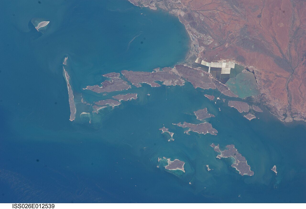
6 min read · 2 sourcesThe Burrup Peninsula, previously known as Dampier Island, is a former island of the Dampier Archipelago that is now connected to the mainland via a causeway. The peninsula and islands together are also known as Murujuga. The peninsula is located in the Pilbara region of Western Australia and contains the town of Dampier as well as the Murujuga National Park. The peninsula includes the Murujuga Cultural Landscape, an area designated as a World Heritage Site in July 2025. The area contains the world's largest collection of ancient (approximately 40,000–50,000 years old) rock art (known as petroglyphs). There is ongoing political debate on whether industrial development on the Burrup is resulting in the physical destruction and disturbance of petroglyphs. The government and industry agree that there is no ongoing damage via atmospheric pollution, while independent academics disagree. The region is sometimes confused with the Dampier Peninsula, 800 kilometres (500 mi) to the north-east. 1
History and toponymy
The traditional owners of Murujuga are an Aboriginal nation known as the Yaburara (Jaburara) people. In Ngayarda languages, including that of the Yaburara, murujuga means 'hip bone sticking out'. Between February and May 1869 a great number of Yaburara people were killed in an incident known as the Flying Foam Massacre. The five clans who took over the care of the land as traditional custodians following the massacre include Yaburara, Ngarluma, Mardudhunera, Yindjibarndi and Wong-Goo-Tt-Oo peoples. First given the English name Dampier Island after the English navigator William Dampier (1651–1715), it was then an island lying 3 kilometres (1.9 mi) off the Pilbara coast. In 1963 the island became an artificial peninsula when it was connected to the mainland by a causeway for a road and railway. In 1979 Dampier Peninsula was renamed Burrup Peninsula after Mount Burrup, the highest peak on the island, which had been named after Henry Burrup, a Union Bank clerk murdered in 1885 at Roebourne. 1
Description of rock art
The Murujuga Cultural Landscape contains the world's largest and most important collection of petroglyphs. Some of the Aboriginal rock carvings have been dated to more than 45,000 years old, and some of the collection is generally estimated to be 40,000–50,000 years old. The collection of standing stones here is the largest in Australia with rock art petroglyphs numbering over one million, many depicting images of the now extinct thylacine (Tasmanian tiger). There are around a million engravings on the peninsula and islands, and around 2,500 archaeological sites which also include quarries, shell middens, and campsites. The Dampier Rock Art Precinct covers the entire archipelago, while the Murujuga National Park lies within Burrup. The Dampier Rock Art Precinct was listed by the World Monuments Fund as one of the 100 Most Threatened Monuments in the world in 2003. Most Murujuga rock art is on 2.7 billion year old igneous rocks. The rock art was made by etching away the outer millimetres of red-brown iron oxide, exposing pale centimetre-thick weathered clay. The underneath very hard igneous rock is dark grey-green coloured, and composed of granophyre, gabbo, dolerite, and granite. The Murujuga cultural landscape was a well-known archaeological and cultural precinct during construction of industry across the area in the 1960s—1980s. However, it was not until 1998 that the first Indigenous Land Access Agreement was executed for industrial use of the Karratha Gas Plant area. This was a retrospective agreement, as the North West Shelf Gas Plant was constructed in the late 1970s and early 1980s, this ‘prior consent’ was not obtained for the North West Shelf project. 1
Road to World Heritage Listing
Concern around the ecological, historical, cultural and archaeological significance of the area has led to a campaign for its protection, causing conflict with industrial development on the site. The preservation of the Murujuga monument has been called for since 1969, and in 2002 the International Federation of Rock Art Organizations commenced a campaign to preserve the remaining monument. Murujuga has been listed in the National Trust of Australia Endangered Places Register and in the 2004, 2006, and 2008 World Monuments Watch by the World Monuments Fund. About 900 sites, or 24.4 percent of the rock art on Burrup Peninsula, had been destroyed to make way for industrial development between 1963 and 2006. The Western Australian government argued for a much lower figure, suggesting that only 4 percent of sites, representing approximately 7.2 percent of petroglyphs, had been destroyed since 1972, citing the lack of a complete inventory of rock art in the region as making assessments is a challenging task. 1
In 1996, a land use plan by the Burrup Peninsula Management Advisory Board divided the region into two areas: 1
a Conservation, Heritage and Recreation Area, spanning 5,400 hectares (13,000 acres), 62% of the Burrup an Industrial Area with an emphasis on port sites and strategic industry, 38% of the Burrup While the plan commented upon "the value of the Northern Burrup for the preservation of its renowned Aboriginal heritage and environmental values", no comment was made on the amount of rock art affected by development and recreational activities. Work commissioned by the National Trust of Western Australia led it to nominate the site for the National Trust Endangered Places list in 2002. 1
World Heritage listing
In July 2025, the site was designated as a World Heritage Site at the 47th session of the World Heritage Committee in Paris, where all member states of UNESCO voted in favour of the resolution. An area of 99.881 ha (246.81 acres) is covered by the designation, which was made under the following criteria: 1
(i) to represent a masterpiece of human creative genius (iii) to bear a unique or at least exceptional testimony to a cultural tradition or to a civilization which is living or which has disappeared (v) to be an outstanding example of a traditional human settlement, land-use, or sea-use which is representative of a culture (or cultures), or human interaction with the environment especially when it has become vulnerable under the impact of irreversible change The site is the 21st world heritage site declared in Australia, and the second one recognised for its Aboriginal cultural values, the other being the Budj Bim heritage areas in Victoria (inscribed 2019). The listing was cited by West Australian Premier Roger Cook of proof that industry and protected cultural sites can co-exist. 1
Visiting
After the Murujuga National Park was closed for some months to allow for its construction, the Ngajarli Trail was completed in August 2020. Traditional owners working in collaboration with the government created a 700-metre (2,300 ft) universal boardwalk, along with interpretative signs. The Murujuga Aboriginal Corporation hopes to improve and enlarge facilities for visitors and to help them appreciate the cultural significance of the site. 1
The text above is adapted from the Wikipedia article “Burrup Peninsula”, available under the Creative Commons Attribution-ShareAlike 4.0 licence. 1
Murujuga is Burrup Peninsula on the Pilbara coastline of Western Australia, according to the structured record cited below. This entry was generated automatically from that record and has not yet been reviewed by a person familiar with the tradition. 2
The source record links this tradition to 8 external registers, which can be verified through the citation. 2